Working on the GiSize Maps project has been a transformative experience, not just because of the final product but also due to the personal and professional development I have undergone. GiSize Maps, formerly known as Geospatial, is a revolutionary application in the field of geographic information systems (GIS) and industrial automation. In this article, I will share my experience and the impact my work had on the project's success, highlighting the skills and contributions that make me a valuable asset to any company.
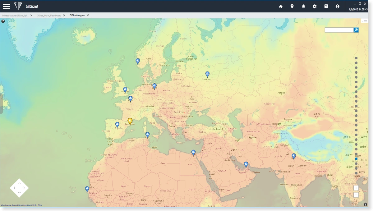
GiSize Maps is an advanced GIS tool that enhances the visualization and navigation of spatial or geographic data in the AVEVA System Platform. This tool integrates multiple industrial protocols and GIS platforms, allowing users to visualize assets in real-time with customized data and animations. GiSize Maps connects with standard GIS providers (ESRI/ARCGIS, OpenStreetMaps, GoogleMaps, Bing) via WMS and WFS services, and also allows the creation of custom map providers based on images or vector files.
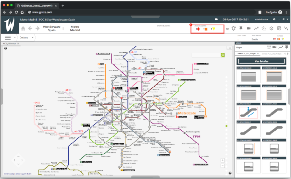
Key Features of GiSize Maps:
- Engineering Time Reduction: Development within AVEVA System Platform IDE, with automatic creation of GIS items.
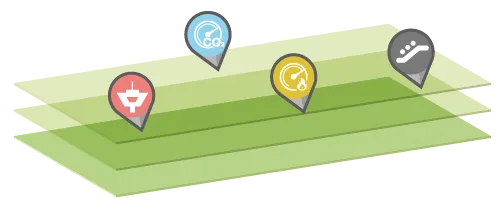
- Interactive Navigation: Native zoom and pan controls for layer-organized maps.
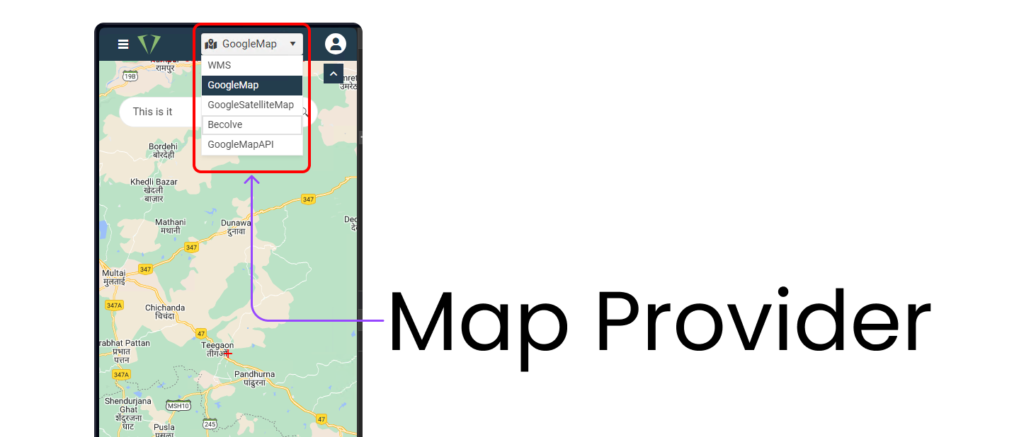
- Map Provider Selection: Compatible with standard providers and allows custom map creation.
- Real-Time Visualization: Monitoring of assets on interactive maps with animations and customized data.
- Custom and Offline Maps: Offers open-source maps and the ability to customize specific maps for factories.
- Map Fusion: Combines different maps and adds WMS layers.
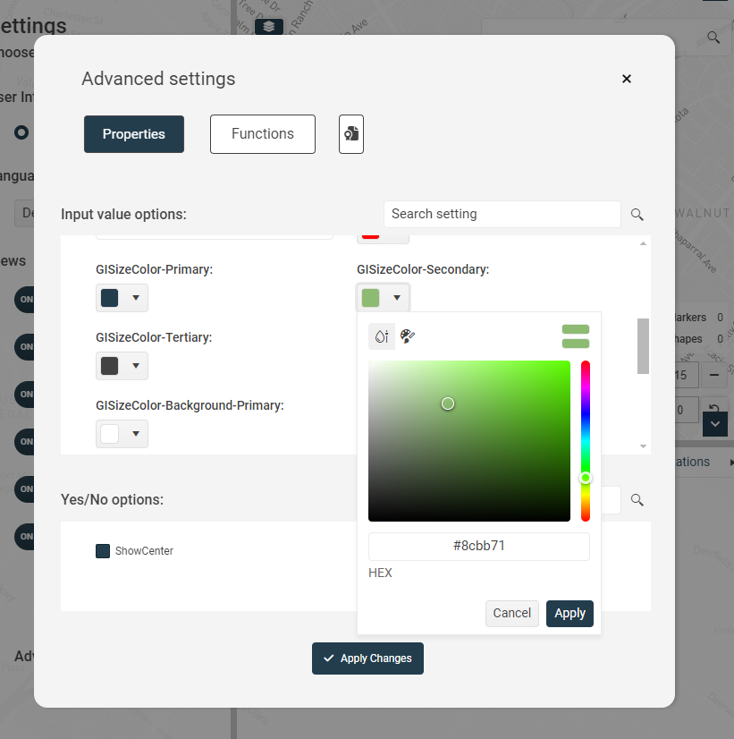
- Highly Customizable Interface: Integrated design system allowing adjustment of all visual aspects.
- Compatibility: Supported on System Platform 2017, InTouch OMI, InTouch for System Platform, and modern InTouch applications.
- Native Controls: Native Multi-touch and gesture controls.
- ArchestrA Graphics: Rendering of ArchestrA graphics within maps.
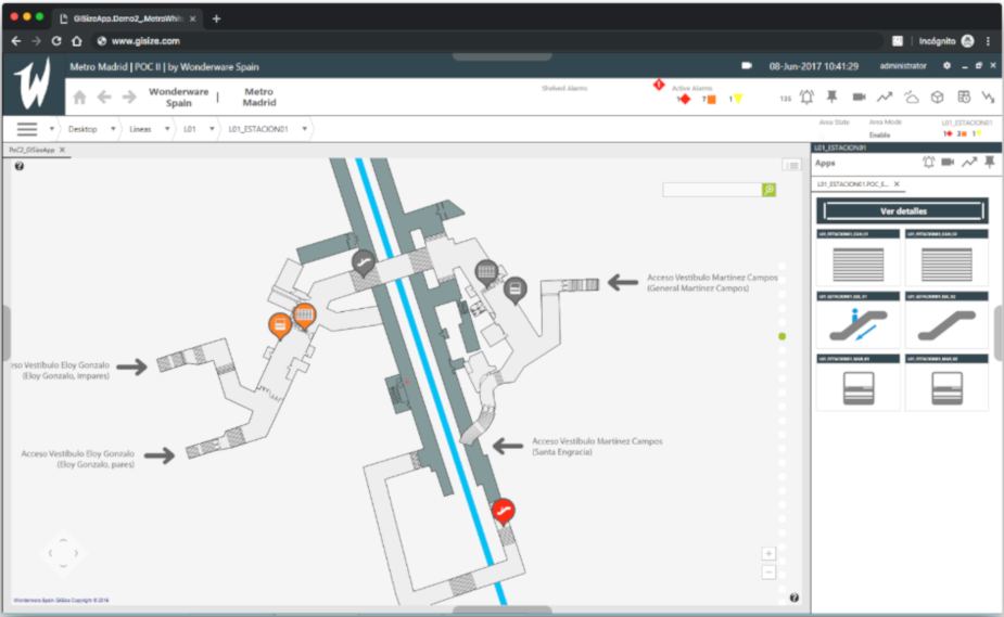
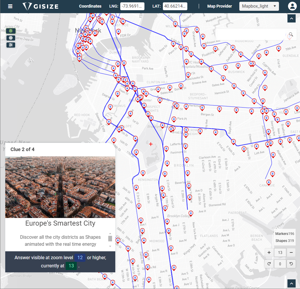
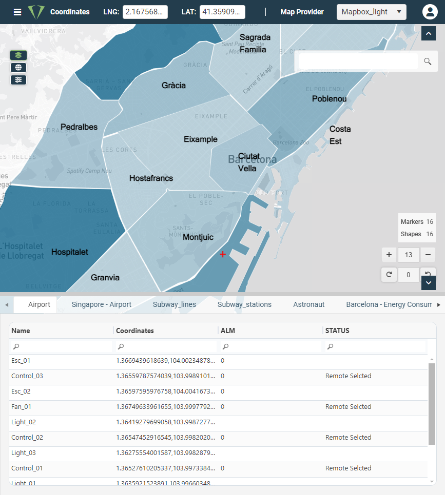
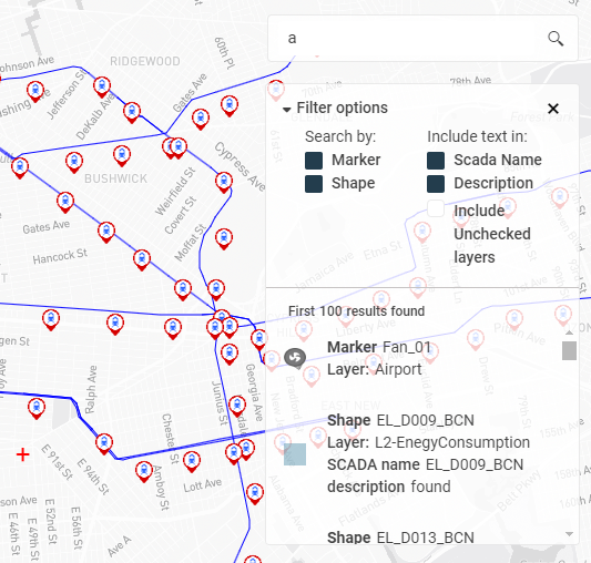
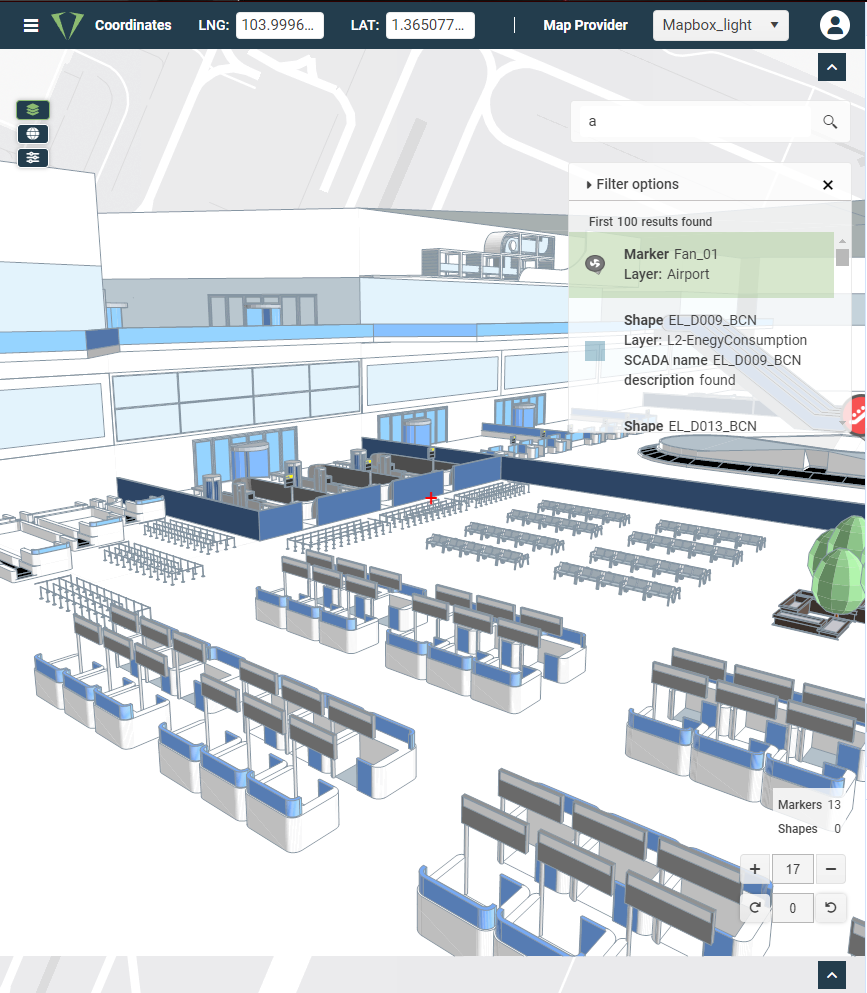
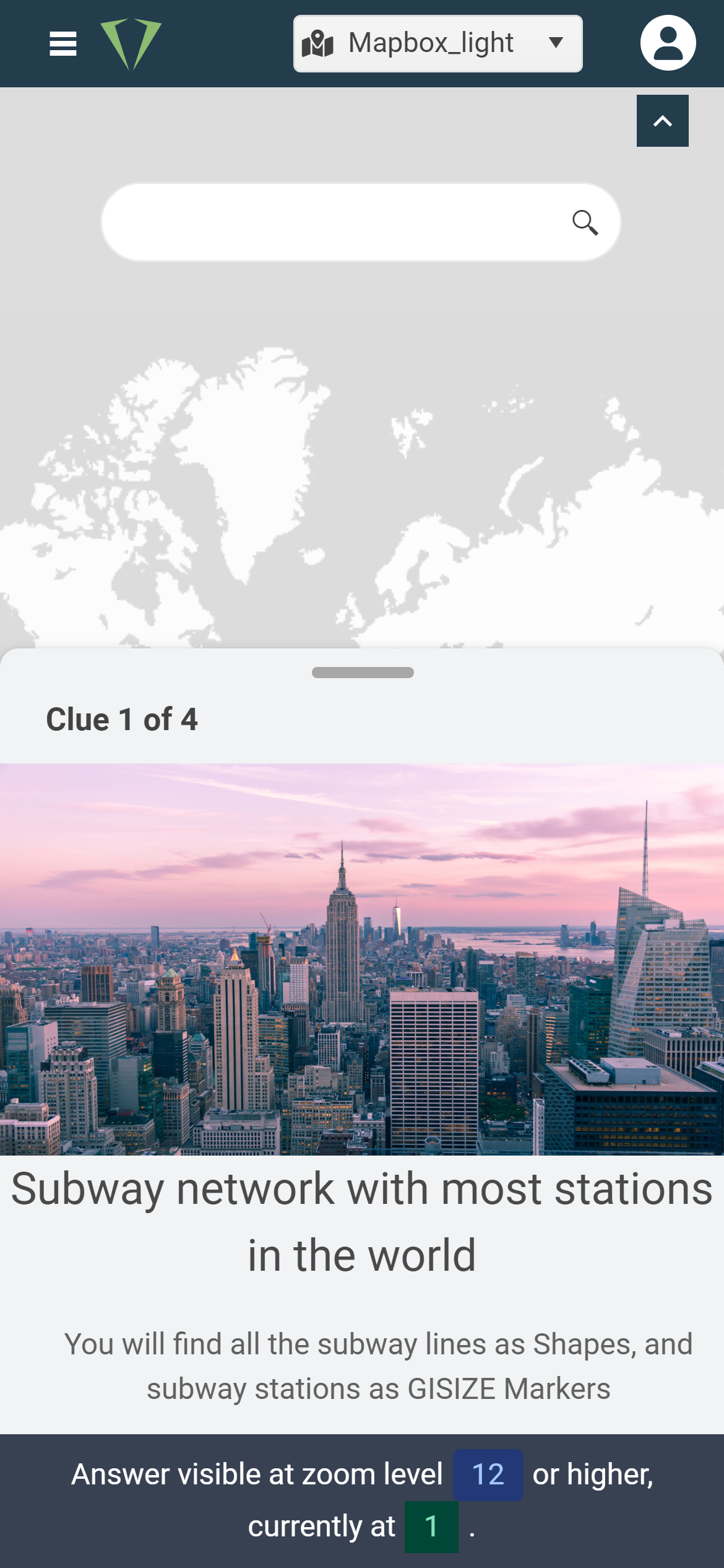
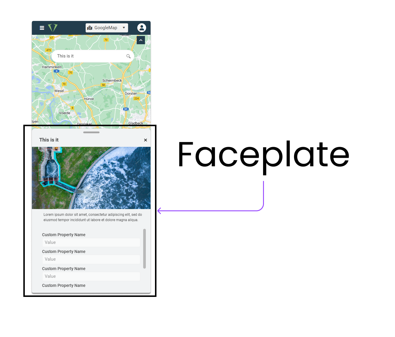
One of the most significant challenges was migrating the service, which initially only operated on OMI of System Platform, to also be available on the web. This process involved developing a flexible and scalable architecture that allowed users to access the service from any internet-connected device. This migration not only expanded the reach of GiSize Maps but also improved the product’s accessibility and usability.
Creating an intuitive and visually appealing user interface was one of my main responsibilities. I ensured that every component was fully responsive, achieving pixel-perfect accuracy. This guarantees a consistent and pleasant user experience across all devices, from large desktop screens to small smartphones.
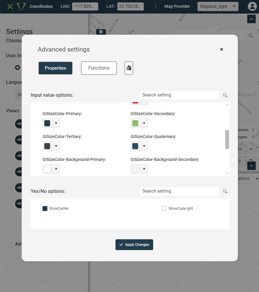
I developed comprehensive web documentation that serves as a user guide for both integrators and end-users. This documentation includes step-by-step tutorials, detailed explanations of each function and parameter, and solutions to common problems. Integrating this guide directly into the user interface allows quick and easy access to the necessary information, improving the user experience and reducing the learning curve.
During the project, I implemented advanced GIS development techniques using tools like Leaflet. I integrated WMS and offline maps, and worked with Mapbox and SVG to create highly interactive and customizable maps. These advanced capabilities enable end-users to visualize complex data clearly and efficiently.
Developing GiSize Maps allowed me to acquire and refine a wide range of technical and project management skills, including:
- Communication between web services and OMI: Developed bidirectional communication solutions between the web platform and OMI, ensuring precise real-time data synchronization.
- Software Architecture: Designed a modular and scalable architecture capable of adapting to various configurations and user needs.
- Advanced GIS System Development: Learned to integrate multiple types of maps and GIS services, enhancing spatial data visualization and analysis capabilities.
- User Interface Design: Developed a fully customizable interface using a design system that allows fine adjustments to all visual components.
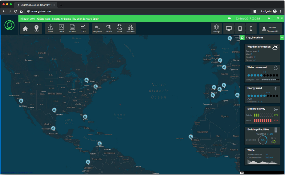
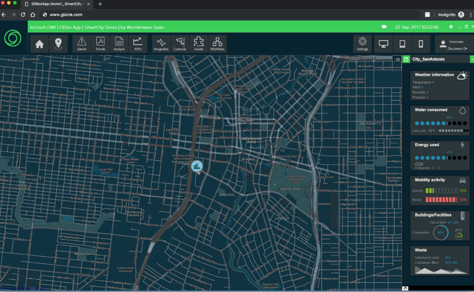
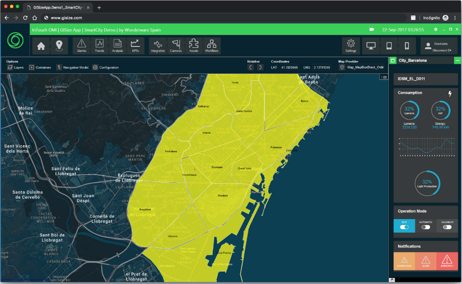
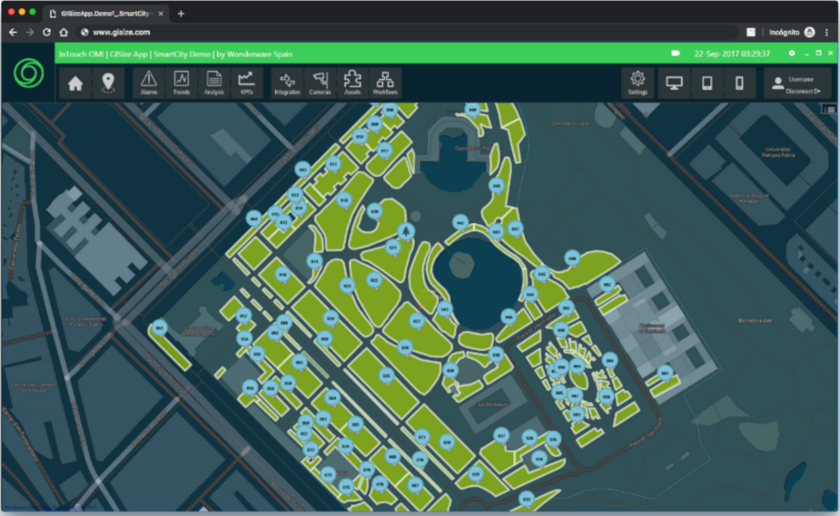
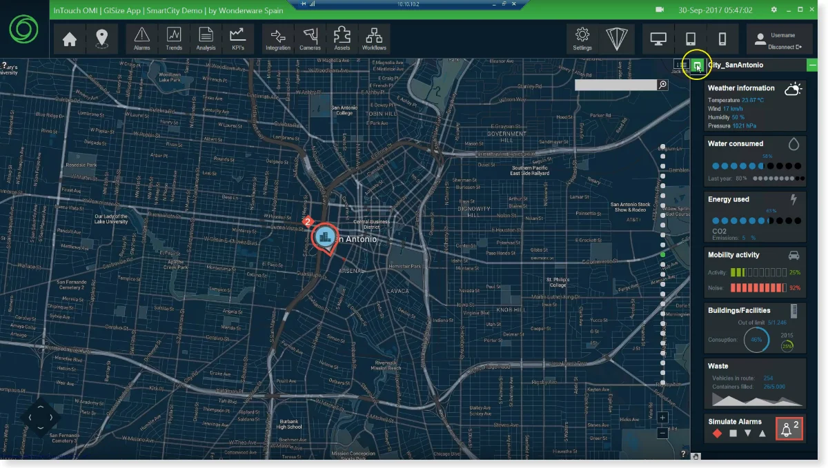
Barcelona has initiated several projects to become a smart city. Working alongside AVEVA Software, GiSize Maps has been a key part of this success. The solution was crucial for improving and managing urban resources such as elevators, escalators, public fountains, and irrigation systems for municipal parks and gardens. Utilizing AVEVA-Wonderware System Platform, GiSize Maps provides a geospatial view of assets in real-time, allowing total control from the map. Operators can access this information both in the control room and in the field via touch tablets and remote access.
In Doha, Qatar, GiSize Maps along with AVEVA Software has been crucial in transforming the metropolitan area into a smart city. The integrated solution allows the management of over half a million assets in real-time from the existing ArcGIS/Esri platform. Operators can view the irrigation pipe network, distributed assets such as sewers or pumps, and the real-time position of maintenance vehicles, all from an interactive map.
Continuing their process of becoming a smart city, Barcelona once again trusted AVEVA Software and GiSize Maps to upgrade the control systems of the interurban tunnels. GiSize Maps provides an advanced solution for monitoring and controlling tunnel assets, such as lighting, smart traffic lights, variable message signs, and ventilation systems. The integration with InTouch OMI allows a geographic representation of assets, facilitating their management and control.
In Navarra, Spain, the Almandoz and Belate tunnels have upgraded their control systems to comply with European safety regulations. GiSize Maps provided predefined industrial templates and graphics that helped meet all the tunnel infrastructure requirements. Additionally, the Scheduler and Sequencer module of GiSize Maps enabled the creation of automatic plans, such as the anti-fog plan or the fire action plan.
My approach focuses on quality, innovation, and collaboration. I firmly believe in the power of teamwork and the importance of creating technological solutions that truly make a difference. My commitment is always to deliver products that not only meet technical requirements but also provide an exceptional user experience.
The work on GiSize Maps has had a significant impact on both BEColve Digital and the industry. We have set a new standard in the integration of GIS systems with industrial platforms, offering our clients a robust and flexible tool. This project has demonstrated that innovation and technical excellence can completely transform the way companies manage and visualize their assets.
My goal is to continue developing my skills and contribute to projects that have a positive impact on the industry. I am constantly seeking new opportunities to learn and grow, and my long-term vision is to lead technological initiatives that drive change and innovation.
My experience in developing GiSize Maps has been a demonstration of my technical skills, innovative capability, and commitment to excellence. I have worked tirelessly to ensure that every aspect of the application not only functions correctly but also provides an exceptional user experience. I am proud of what we have achieved and am convinced that my skills and experience can bring significant value to any company looking to innovate in the field of technology and industrial automation.
This article not only highlights my participation in the project but also underscores the importance of collaboration, creativity, and dedication in developing advanced technological solutions. I am eager to continue applying these principles in future projects, contributing to the success of my team and the advancement of the industry.
